Monday, September 13, 2010

September 10-12, 2010 Middle Saranac Lake

Well, we finally did it! After about 15 years of no camping, we not only went camping this weekend... we went kayak camping! Back in the day, we used to go to Indian Lake and paddle our canoe full of gear out to the islands for a weekend in the woods with our family &/or friends. We had ONE perfect trip as far as weather was concerned. After that almost all other camping trips we ever took were almost guaranteed rain. Tim was convinced he was cursed and the camping trips stopped.

The group we kayak with has little by little gotten Tim interested again. He's been online researching all sorts of camping gear. The trip was all planned and site reservations made. Now we had to be able to pack whatever we needed into the hatches on our kayaks: tent, sleeping mats, sleeping bags, food, etc. We headed out on Friday morning and headed for Middle Saranac Lake. The 10 of us arrived at the boat launch and packed up our boats and headed for our sites.


Some of our gear
We went down a channel that opened into Middle Saranac Lake. The weather was holding in spite of the dark clouds over head. The waves were small and we were able to paddle across the lake without any trouble. Once we reached the other side we went down a channel that lead us to Weller Pond. As we paddled through I noticed that the trees on the shore looked like they had been trimmed along the bottom edge. Some of us think that maybe deer trim the bottom branches, but not sure.
Paddling Middle Saranac

Channel to Weller Pond


We paddled across Weller Pond and left Doug, Cindy, Patty, Victor, Cindy & nephew Alec at their site on Tick Island. Gary, Sharon, Tim & I had to continue on past Tock Island to our site, # 85. We had a nice set of stairs leading up from the shore to the camp site. We got our tents all set up and then looked for fire wood. We had a beautiful view looking out over Weller Pond.

Tim gets us set up
We went over to Tick Island for dinner. We each had a nice freeze dried meal. Mmn Mmn. Tim had Spaghetti with meat sauce and I had Beef Stroganoff. They were pretty good. (No room in a kayak for a grill and pans for cooking).


View from Our Camp Site

We paddled back to our site before dark and went to bed at 8:15! It was dark and we were tired, so why not?

Saturday morning you couldn't even see the water. It was so foggy out! We fixed breakfast. Have you ever had freeze dried scrambled eggs with bacon? Don't. After Tim had a taste, we tossed them and had a bagel with peanut butter instead.

Me on Friday night

Alec, Doug, Cindy & Chris


The fog cleared and Gary sounded his chicken call. We paddled over to Tick Island to meet the group for our day trip. We were heading for Lower Saranac. We went out the channel that connected Weller Pond to Middle Saranac. As we made our way across the lake I paddled directly over a large rock just below the surface. I didn't tip over, but it left a nice scratch across the bottom of my boat. Ouch.


Saturday morning


Tim has breakfast
Once in the channel to Lower Saranac we saw a Bald Eagle soaring above us. I wasn't able to get a picture, but Cindy did and will get me a copy. What a beautiful bird! We arrived a the manual lock and loaded in. Gary stayed out to operate the lock for us. Once in we held on to ropes to steady our boats while the water level dropped. Gary let us out of the lock and met us on the other side.

In the lock

We paddled a short distance into Lower Saranac Lake and spotted a nice sandy beach. It looked like a nice place for lunch, so that's where we went. We "parked" our boats on the shore and ate, explored and waded in the water. It was a very nice camp site. A short time later we headed back to our sites. You couldn't have asked for a nicer paddle. We were probably gone about 4 1/2 hours.


Lunch time
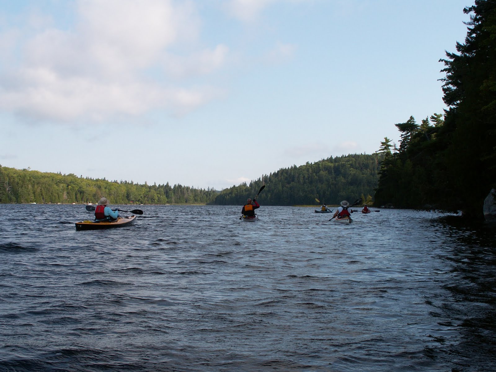
Sunday morning we packed up and headed out. The weather had taken a turn for the worse. Wind & waves had both picked up. Thank God our boats were loaded and had some extra weight in them. It was a much tougher paddle. We fought each wave and the wind as we headed across the lake. Tim & I headed for Ship Island to catch a break from the waves for a little bit. As we approached we heard a loud screech and watched a beautiful Bald Eagle fly out from the Island and fly away. What a great view we had. Again, no picture. The waves meant that my camera was secured under my spray skirt. Darn!


Nancy

Once we got back to the boat launch we packed up and headed out. It was a good weekend. Tim is ready to buy a new tent and will camp again!

Saturday afternoon
Alec, Cindy, Patty, Victor, Chris

Monday, September 6, 2010

Monday September 6, 2010 Hudson River

Sign at the gate

Today we started out from the boat launch at Richardson Street near the Feeder Canal in Glens Falls. We put the boats in near the dam and paddled towards the boat launch at Big Boom Road where we paddled last weekend. We decided to paddle this direction so that we would have an easier paddle on the way back; wind and current going with us.

Boat Launch at Richardson Street

The river split right away and we stayed to the right side.The water temperature was nice and there wasn't too much wind either. As we paddled along we noticed a lot of trees sticking up in the water. We were really curious why there were so many. You had to be careful not to hit the tops of the shorter stumps, as the waves kept them somewhat hidden.


We saw a Heron walking along the shore. He was funny. His beak was always open. Don't know if he was fishing or just walking around. As usual we scared him off.


Heron along the shore
In this area of the river there were a lot of piles of rocks that looked like little islands. A few of them even had a tree on them. A man at his dock told us what the piles had been used for years ago. Cables were strung between the piles of rocks to catch the logs floating down the river. Apparently they were sorted according to their final destination or use. The logs would be across the entire river and be about 20 feet high. It was very interesting to hear about.


Tim approaches the "rock islands"
Shortly after this we turned back. We were meeting Megan back at the launch after her bike ride to Lake George. We'll have to do this stretch again when we have enough time to go from launch to launch.
Piles of rocks

Some of the rock piles


End of another trip

Monday, August 30, 2010

August 29, 2010 Fish Creek

We chose Fish Creek so we could rent a kayak for Megan at the Kayak Shack. We wanted a shorter paddle after our long day out yesterday. As we headed out, Megan commented that her boat had a mind of it's own. She wobbled along as we headed towards Bryant's Bridge. Not a great kayak; too wide for her.

Kayak Shack

Megan heads out

We watched for turtles and fish as we went. Megan was pretty good at turtle spotting and enjoyed snapping pictures before they dove into the water.


Megan spots a turtle basking on a log
We had a number of boats to contend with. Most were respectful and didn't leave a large wake.


We looked for the HUGE snapping turtle Tim had seen early in the spring, but no luck. Tim said when he found it in the spring he thought that it was some dirt on the shore... and then he saw the huge head!
As much as we wanted to see the snapping turtle, we never found it.


We had a nice paddle with Megan. She goes with us when our schedules allow it. Next year she might have her own boat!
Tim & Megan
Tim & Nance

Sunday, August 29, 2010

Saturday August 28, 2010 Hudson River Park

For a few years when Tim & I drive north on I 87 we have noticed a boat launch near Exit 18. We decided to take our kayaks and find out how to get there: take Exit 18 and turn right onto Big Boom Rd. Follow it to the end and you will arrive at Hudson River Park. The park opened in 2003.

Sign at the Hudson River park
We launched our boats at the ramp and headed for the Northway. The water was nice and calm. We went under the Northway and noticed a camp for sale on the other side. Tim was interested, but I told him it was too noisy to even consider!

Looking towards the Northway
A little farther down the Hudson River the hill on the shore got much steeper. The houses were on the top of the hill and there were LOTS of steps leading down to the river. Two houses had lifts to get up and down from the water. Sweet. (I would take one of those houses!)

Chair lift
We saw lots of things on this trip. We looked right towards West Mountain at one point.


We found a beaver dam with a beaver lodge in the higher water behind it. The water was about 12" higher behind the dam. The dam had some loosetrife growing on it right next to the spot where the water was coming over.


Water flowing over the dam to the right of the flowers

Nance in front of dam & lodge


In one area we found nesting boxes that must have been put there by a conservation group. There was a bridge in that area where the area has been posted.
Bridge


We passed a water treatment plant and continued paddling as far as we could go. We came to some rocks and rapids. We aren't quite sure what was on the other side. We thought we would be able to paddle up to a dam, but no luck.


On the way back we followed a heron for a while. We were able to paadle up and get a picture before it flew off.


It was a really nice day to be out in our boats. I think we paddld 3.5 hours!


Nance framed by some trees


Seal Cove Pond Friday August 20, 2010

Seal Cove Pond was our least favorite paddle of the four paddles we did at Acadia. Seal Cove Pond is in a very remote area. You have to drive down a long dirt road to get there. It is 4.5 miles around and takes about 2.5 hours to paddle. It is shallow & marshy. The eastern shore is part of Acadia National Park. The western shore & the island are privately owned. There is a beaver lodge at the southern end.


Doug launches his kayak

Looking North from the launch


Looking south


The guys paddle along

The beaver lodge

Thursday, August 26, 2010

Eagle Lake Thursday August 19, 2010


Eagle Lake is the lake you look down on from Cadillac Mountain. You have a beautiful view of it from the Blue Hill overlook. This lake is 4 miles around and is 110 feet deep. It is the largest lake on Mount Desert Island. It is a moderate kayak paddle. There are hiking paths and carriage roads around the perimeter. It is about a 3 hour paddle.


Tim paddles from the launch

The launch was breathtaking. The water was calm and the mountains reflected on the surface. We headed off to our right and started paddling along the shore. There were lots of people walking on the paths around the lake. We were able to paddle and take a lot of pictures.


Along the shore


We saw a stone arch. It looked like it may have been the remains of  building. It seemed out of place to be a bridge. If you look at the picture you'll see the ground through the arch opening. We didn't walk the trail, so I can only guess. Perhaps on our next trip back, we can check it out.


The morning was nice as we were the only boats on the lake for most of our trip. I hate it when strangers clutter my pictures!


We saw a bird perched as we approached the launch area. We paddled close to get some photos of the heron (?) and were promptly told to leave the restricted area. There were white markers warning boaters to keep out - but there weren't any along the shore where we paddled in. Oh well. Better markers would have been obeyed.


Heron?


Tim and I returned to the same parking lot where we had launched so we could take a bike ride on the carriage road. The water was MUCH rougher. A few hours make a huge difference. I'll tuck in a few bike pictures as well. We enjoyed our ride and had some great views.


Late afternoon waves at Eagle Lake


Nance on Carriage Road to Witches Pond
Carriage Road Bridge

Witches Pond